

Appearance
3D map
On this page you will turn on the 3D map, control how much of it loads, and keep its credits on screen.
The 3D map shows the real place around your show: terrain and buildings, built from photographic imagery. Use it to see how a design sits over a stadium, a square or a coastline, and to find the real ground height.
Every show starts with the 3D map off and a flat satellite picture under the origin. You turn it on per show, and the choice is saved with the show.
Turn it on
- Check that your origin is correct. See Location.
- Click the Environment icon on the top bar.
- In the Map section, turn on 3D map.
- Wait a moment. The map loads in pieces, coarse first and sharper as you get closer.
To go back to the flat picture, turn 3D map off. The map stops loading.
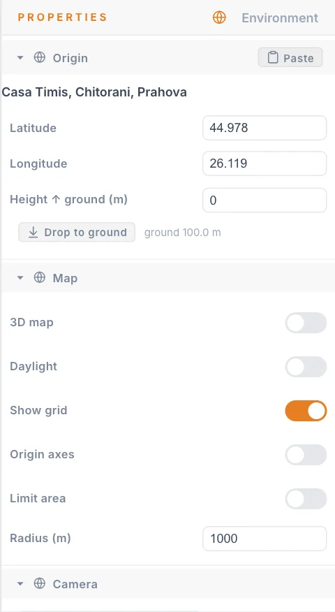
Limit area and Radius
These two settings decide how much of the world loads.
| Setting | What it does | Default | Good starting value |
|---|---|---|---|
| Limit area | On loads and draws only the map within Radius of the origin. Off loads the map everywhere you look. | On | Leave on. |
| Radius (m) | The distance from the origin that stays loaded. Minimum 10, steps of 50. | 200 | Enough to reach past your Launch Pad and your audience area. |
Why they matter
The 3D map is heavy. Everything inside the radius has to be downloaded, kept in memory and drawn on every frame.
- A smaller area loads faster and keeps the viewport smooth.
- A smaller area uses less data, which helps on a site connection.
- Nothing outside the radius is downloaded or drawn when Limit area is on, so the view ends in empty space at that distance. This is normal.
Turn Limit area off only for a moment, when you need to look further away. Turn it back on afterwards.
Radius (m) also controls two other things:
- The flat satellite picture is twice the radius across.
- The reference grid from Show grid is twice the radius across.
If you change the origin, the loaded area moves with it.
Keep the credits visible
While the 3D map is on, credits appear in the bottom-left corner of the viewport. Imagery comes from Google, and the list also names the data providers for the part of the world in view, so the text changes as you move the camera.
Do not hide the credits
The credits must stay readable whenever the map is shown. The app gives you no way to collapse them. Do not cover or crop them when you share a screenshot or screen recording of the 3D map.
Some credits are links. They open in a new browser tab.
Find the ground
With the map on, you can seat the show on the real ground with Drop to ground. See Ground height. A Launch Pad can use the same surface with Conform to ground. See Ground placement.
Tips
- For a night show, dim the map with the Time of day slider in the viewport settings, so drones stand out against it.
- If nothing appears, check that the origin is where you expect and that your camera is inside the radius.
- Work with the map off while you shape formations. Turn it on to check placement.
Next
Set up where the drones start on the Launch Pad page.